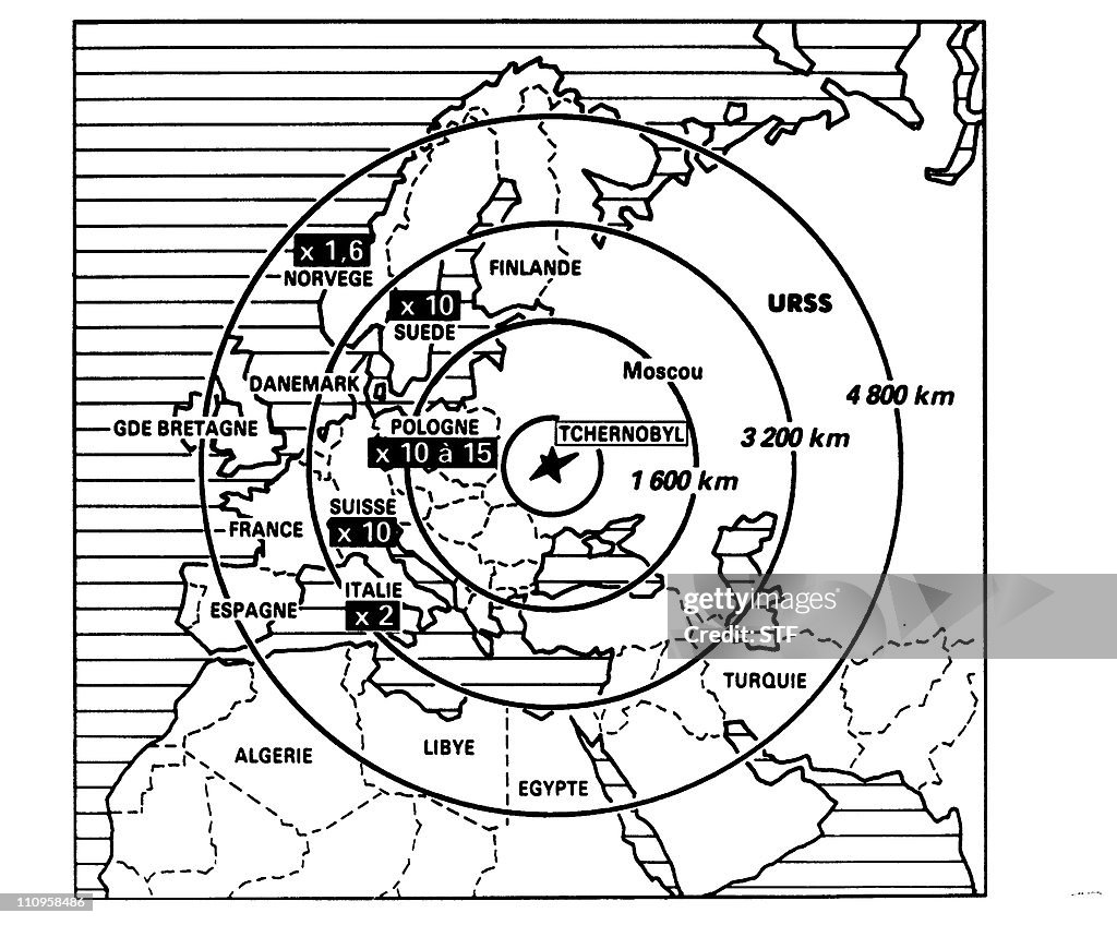
Reproduction d'une carte illustrant les
reproduction d'une carte illustrant les différentes zones touchées par les retombées radioactives de l'explosion du réacteur No 4 de la centrale nucléaire de Tchernobyl, le 26 avril 1986, le plus grave accident nucléaire du XX siècle.Undated photo of a plan showing the areas concerned by the radioactive contamination produced by the Chernobyl nuclear plant No. 4 reactor's blast, 26 April 1986, the world's worst nuclear accident of the 20th century. (Photo credit should read STF/AFP via Getty Images)

COMPRAR UMA LICENÇA
Como posso usar esta imagem?
R$ 3.000,00
BRL
DETALHES
Restrições:
Contacte o representante local para todos os usos comerciais ou promocionais. Direitos editoriais totais no Reino Unido, EUA, Irlanda, Itália, Espanha, Canadá (não inclui o Quebec). Direitos editoriais restritos em qualquer outro local; contacte o representante local.
Crédito:
ID Editorial:
110958486
Coleção:
AFP
Data da criação:
02 de maio de 1986
Data do upload:
Tipo de licença:
Info sobre autorização:
Sem autorização Mais informações
Fonte:
AFP
Código de barras:
AFP
Nome do objeto:
APP2000120989973
- Chernobyl,
- Mapa,
- Reator Nuclear,
- Usina Nuclear,
- 1980-1989,
- Acidente nuclear de Chernobil,
- Acidentes e desastres,
- Anti-higiênico,
- Central Nuclear de Chernobyl,
- Cinza nuclear,
- Condição Ruim,
- Energia Nuclear,
- Explodir,
- Filme de arquivo,
- França,
- Lixo Tóxico,
- Manufaturar,
- Mostrar,
- Paris,
- Plano - Documento,
- Poluição,
- Poluição do Ar,
- Preocupado,
- Tecla de Adição,